Get to Know Hamamatsu
- Enjoy
- Watch
Sea Lake Report: Walk along the Okuhamana Nature Trail in search of spectacular views.
Lake Hamana may have a strong image of marine leisure, but not many people know that it is actually a place where you can enjoy hiking and trail running. To the west are the Kosai Mountain Range, and to the north are the mountains Jogamine and Tommakuyama, where hiking trails are available. It is also popular as a low-altitude hike that can be easily done on holidays.
This time, I used the Tenryu Hamanako Railway to walk the course from Hamanako Sakume Station to the summit of Jogamine and descend to Kiga Station, and I would like to share with you how it went.
This time, I used the Tenryu Hamanako Railway to walk the course from Hamanako Sakume Station to the summit of Jogamine and descend to Kiga Station, and I would like to share with you how it went.
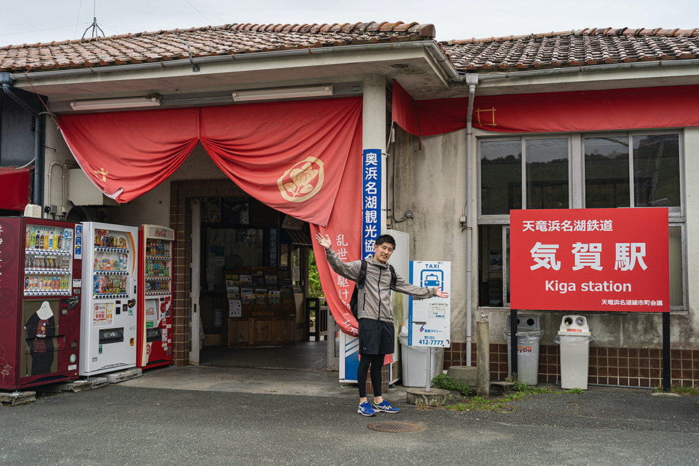
Depart from Kiga Station. The time is 8:30am.
It may seem a little late to start climbing, but since the trailhead is close to the station and it’s not a high mountain at 433 meters above sea level, this amount of time is just about right.
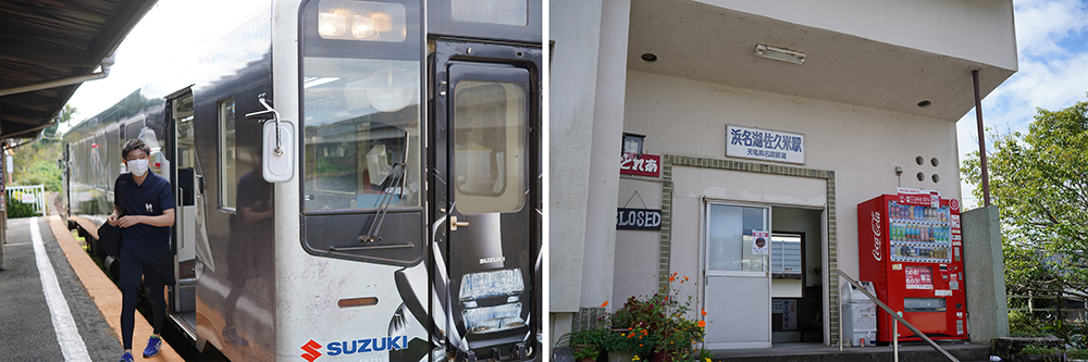
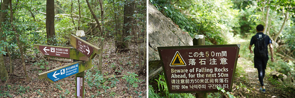
Just a few minutes from Kiga Station on the local line, which is a one-car, single-track train. Arrived at Hamanako Sakume Station.
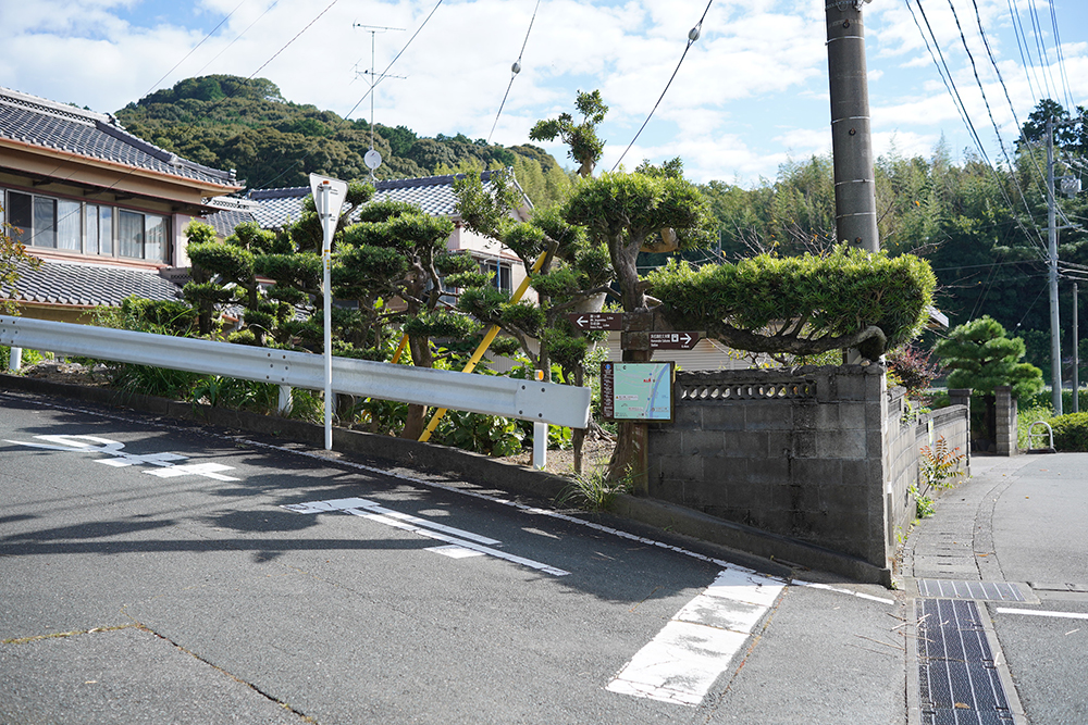
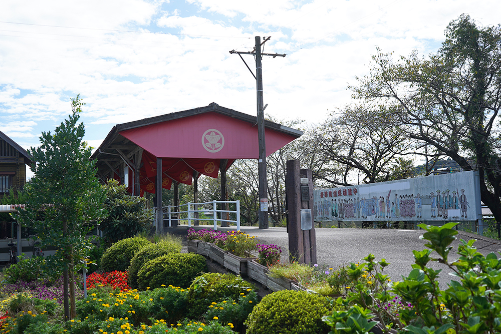
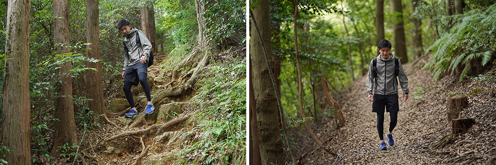
After warming up at the station, it was time to start climbing. The entrance to the Okuhamana Nature Trail Sakume Course is along the national highway walking east from the station.
After about 40 minutes of climbing up a steep path from the trailhead, you will arrive at Tengu Rock, a spectacular view point. It was a clear sunny day when we left, but some clouds had appeared.
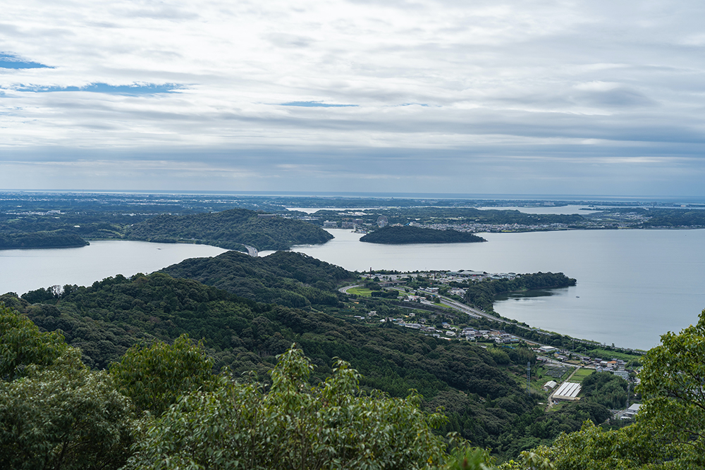
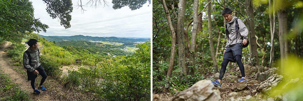
This place, which juts out towards Lake Hamana, overlooks the Tomei Expressway that runs below and the entire Lake Hamana, making it the perfect place to take a break.
There are hiking trails around Mt. Yogamine and Mt. Tomimaku as part of the Okuhamana Natural Recreation Forest, and there are many information boards, so even those with little mountain climbing experience can enjoy hiking with confidence. Of course, you will need a map and preparations for climbing, so please be careful.
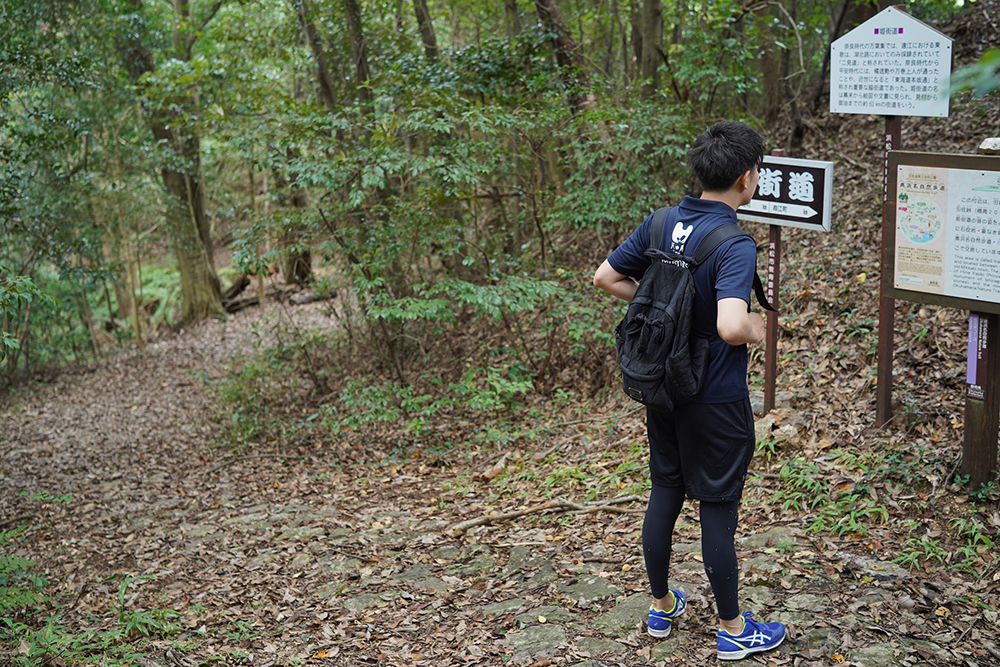
After 30 minutes from Tenguiwa, we arrived at Inasa Pass. This is the intersection with Hime-kaido, a side road of the Tokaido. The area is paved with cobblestones, and retains the appearance of an old highway.
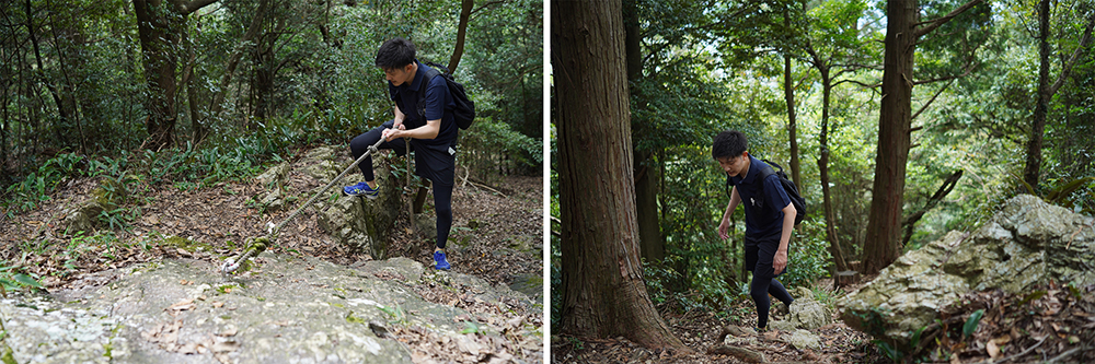
1 hour after leaving Inasa Pass. Once you get past the difficult part of Yogamine, “Shishi Otoshi”, you will finally reach the summit.
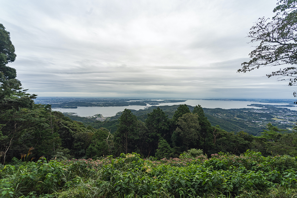
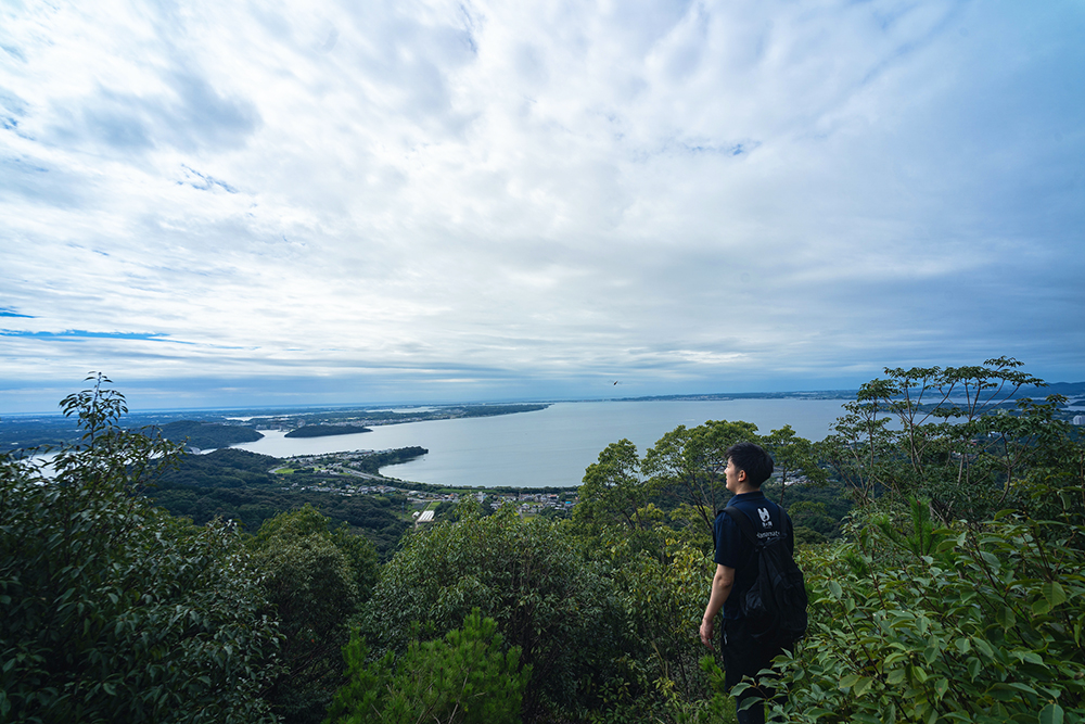
The view from the top of the mountain has an outstanding sense of openness, and you can see not only Lake Hamana but also the Enshu Sea in the distance. It feels like the fatigue from climbing all the way up here disappears.
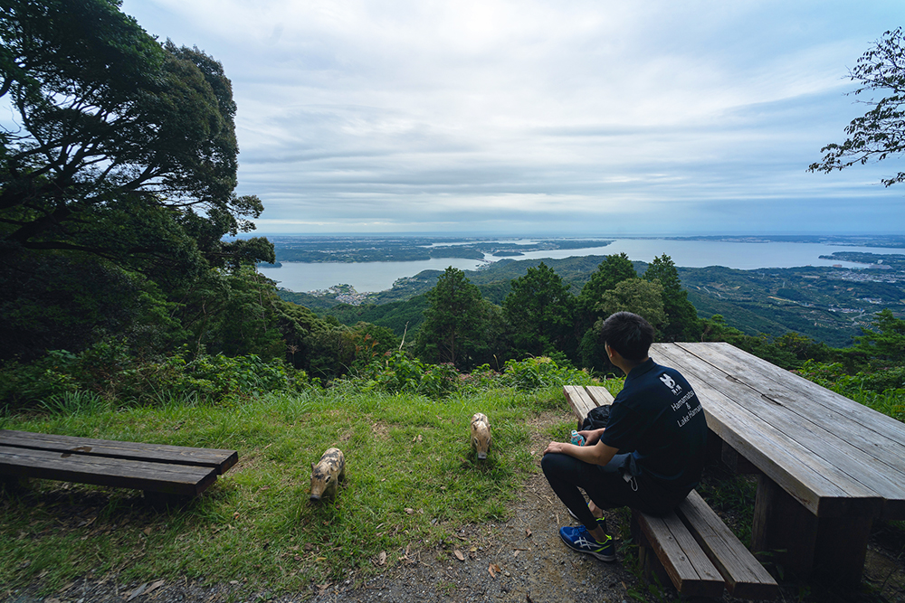
We started climbing from the trailhead at 9am and reached the summit just in the afternoon. The course from Sakume Station is a course that climbs a steep slope all at once. There are several ups and downs along the way, which may be difficult for first-time climbers, but those who are used to walking on a regular basis should have no problems.
After taking a lunch break at the summit, we headed back down the mountain via the Hosoe course towards Kiga Station. I am leisurely descending the gently sloping mountain path, but my knees are starting to laugh from the lack of daily exercise. Even though it was a casual low-altitude hike, I probably should have let my body get used to it a little more before climbing.
2 hours of walking while taking care of my knees. We arrived at the trailhead for the Hosoe course. The Hosoe course has a gentle slope, but there are exposed rocks here and there, making it a worthwhile climb. I can see why many people choose this course.
The appeal of the Okuhamana Nature Trail is the large number of courses you can choose from.
The Sakume course we climbed, and the Hosoe course we descended. Furthermore, there are various courses to choose from, such as the Okuyama course leading to Mt. Tomimaku and the Tadaki course of Mikkabi, as well as the Hime-kaido road that intersects with the mountain. One of the best parts of this route is that each starting point is close to public transportation such as Tenryu Hamanako Railway and Entetsu Bus, allowing you to choose your course with great flexibility.
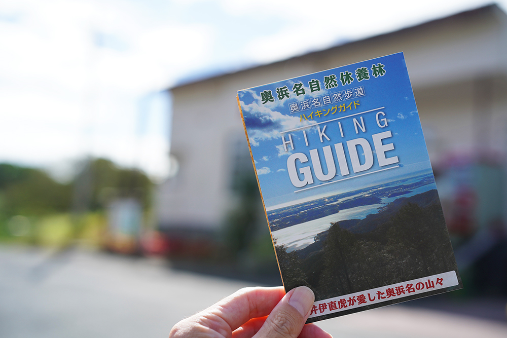
A hiking map can be found on the Hamamatsu City Kita Ward Office website, so please use it to plan your trip before heading out.
(Hamamatsu City Kita Ward Office HP →
「 https://www.city.hamamatsu.shizuoka.jp/n-machi/hikingguide.html)」
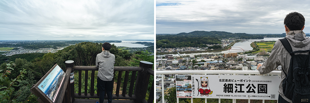
Nissangatsu Pass (left photo) and Hosoe Park Observation Deck (right photo), located along the Hosoe Course, have been designated as Hamamatsu City’s “Kita-ku Naotora Viewpoint”, a spectacular view point. You can see the scenery of a town living in harmony with nature, such as the scenery of Lake Hamana and the activities of the people who live here. When you look at it leisurely, you can’t help but forget how time passes.
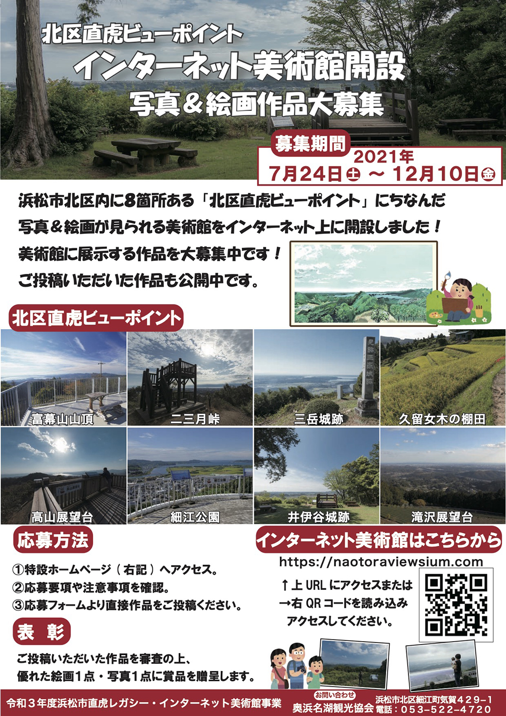
There are eight Kita-ku Naotora Viewpoints in Kita-ku, Hamamatsu City, and photo and painting contests are held in connection with each location. (until December 10, 2021 →This event has already ended.)
Photos taken within the past two years can also be submitted, so if you have already visited or are planning to visit, please apply.
Walking, resting, caring, and resting again. I managed to reach my goal, Kiga Station. (About 3 hours from the summit) I think this is a mountain that you can easily enjoy even if you are interested in mountain climbing or hiking but are nervous about climbing deep in the mountains or high mountains.
I myself have walked various courses around Lake Hamana, and each course is different and has its own charm, including courses that visit abandoned temples and courses that offer spectacular views that extend beyond the mountaintops. It rarely snows in the winter, so you can enjoy it in any season.
To relieve the lack of exercise, it might be a good idea to go on a hike to enjoy the rich natural scenery.
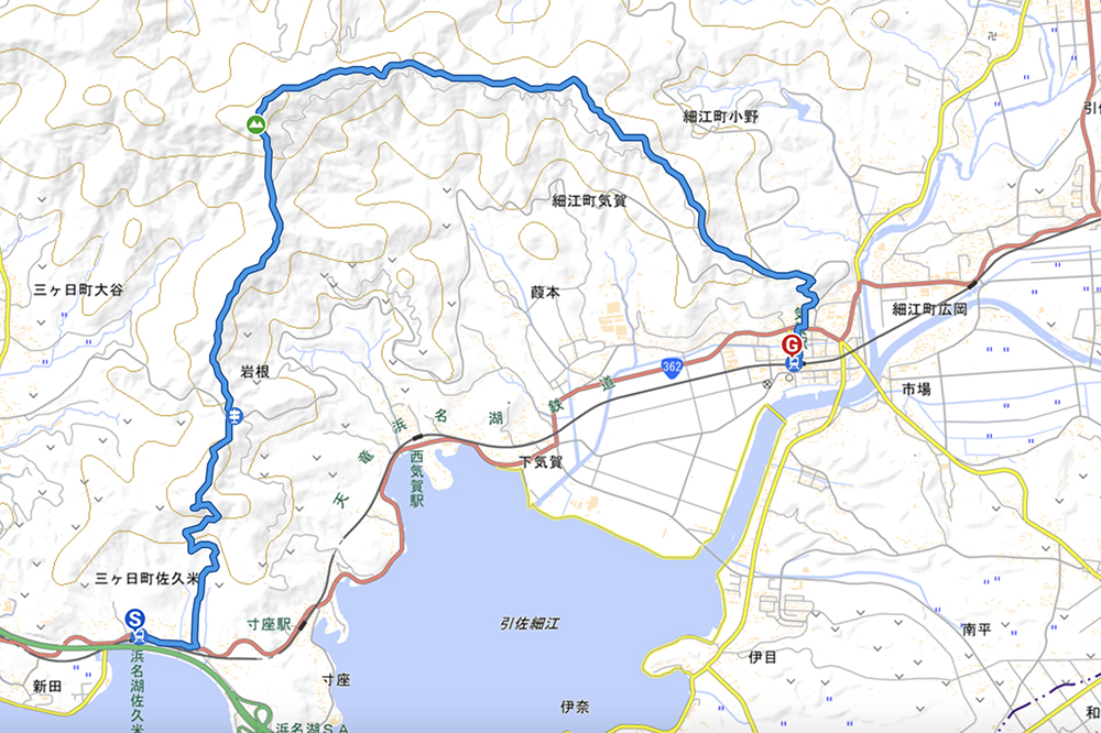
Here is the itinerary I walked this time. The journey was about 12km and took about 6 hours (including breaks).
Now, which course would you like to draw?